Page 1 of 1
iPad navigation program
Posted: Fri Nov 17, 2017 7:56 am
by Flyer
For several years I have been satisfied with my iPad used as a chart plotter. I have Garmin BlueChart and Active Captain and use a bluetooth GPS receiver called a Garmin Glo. The BlueChart cost $50 and the AC was free. Right now a friend is attempting to replicate my set-up and found that about two weeks ago Garmin and Active Captain have released a new chart program for about $168 and the old BlueChart program is no longer available. With so many free or low cost chart programs available I would like to pose this question: Do any of you know how my friend can get a good iPad compatable chart program which can display those very helpful AC icons for less than $168?
Re: iPad navigation program
Posted: Fri Nov 17, 2017 8:16 am
by AMCarter3
Navionics for iOS devices is fantastic. Every boater I know uses it. And the cost is low. See:
Boating USA on the App Store
http://tinyurl.com/y93673bw
Re: iPad navigation program
Posted: Fri Nov 17, 2017 3:40 pm
by thinwater
+1 for Navionics.
I've got a Garman in the cockpit, but I love the Google earth overlays on Navionics. I use it on a tablet, just because the screen is bigger.
Re: iPad navigation program
Posted: Fri Nov 17, 2017 6:38 pm
by Ortolan
+2 for Navionics
For 2 years I had been using Garmin BlueCharts to compliment my old RayMarine E120s, but got sick of Garmin failing to regularly update their charts, particularly bad stretches where the buoys have been moved years ago, but Garmin still shows the old locations. Reading all of the ActiveCaptain hazards & everyone's opinion of each one gets old - particularly the ones where one person said they hit bottom & the next 10 say "never saw less than 12'". That, along with the current Garmin/ActiveCaptain mess - I am done.
While the Navionics Sonar Charts on my E120 were hard to read, on an iPad - WOW! You can choose your own intensity, shading depth levels. The Auto Routing is amazing! Even on the ICW, it somehow shows a route with extreme accuracy, favoring deeper water when needed, other times cutting corners when deep. I thought I caught it messing up once as it had us veering off the ICW, taking a shortcut thru an oxbow - I didn't take it, but then noticed a large monohull who did, so it was right after all. Obviously use with caution.
With the Navionics Sonar Charts you can (usually) see clearly where the shoals are starting to build & I don't even bother with ActiveCaptain any more. Anytime you want (even every morning) you can update all of your loaded charts with one touch.
Navionics has a free 15-day trial with charts included so you can give it a try. The only bad news is that since Garmin just bought Navionics, it might soon be dumbed down too.
Re: iPad navigation program
Posted: Sat Nov 18, 2017 7:58 am
by Flyer
I thank you for your thoughtful responses. I guess the answer to my question is that there is no program which will display the Active Captain info onto a chart other than Garmin.
Re: iPad navigation program
Posted: Sat Nov 18, 2017 8:27 am
by Allie-May
Plan2Nav will overlay ActiveCaptain but only on Android; it is currently not supported on iOS. I mainly use it for trip planning and as a backup.
Re: iPad navigation program
Posted: Tue Dec 05, 2017 9:56 am
by kjoverbeck
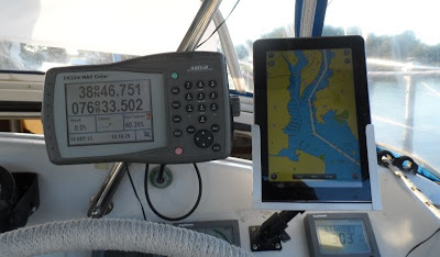
I just downloaded "Aqua- Map" on my IPad. I like the Garmin BC better but this has a very easy to use AC overlay. App was free but chart of US, Canadian great lakes and Bahamas was $19.95.
Re: iPad navigation program
Posted: Thu Dec 07, 2017 8:23 am
by SecondWind
iSail.Uses NOAA charts for free and the app is free.
Re: iPad navigation program
Posted: Thu Dec 07, 2017 8:59 am
by AMCarter3
Terry,
Did you mean "iSail GPS" for $7.99 at the Apple App Store? It gets great reviews and is certainly inexpensive.
I don't mean to put it down, however, I have it and I much prefer Navionics. I find Navionics to be much easier to use, much faster and easier to create a track without needing exact waypoints, easier to store tracks, has access to weather, tides & currents inside the app, has a far more clear chart image on an iPad, its zoom in/out feature allows you to move around and in\out extremely easily -- it is quite amazing. The only downside I see to Navionics is that it does not rely on waypoints.
Re: iPad navigation program
Posted: Sat Feb 08, 2020 12:37 pm
by John&Ria
Due to an operating update to my iPad, I recently lost access to Garmin Bluecharts, which I've used for route planning and as a backup to our primary (Navionics) navigation system on the chart-plotter. I'm currently testing the Navionics Boating Marine & Lakes app under their free trial offer. So far I've been impressed by what I see, and the reviews here from a few years ago appear to be very favourable. I would be interested to know if any opinions have changed based on longer term usage and/or changes to what is offered.
Also, it appears the annual subscription price is $49.99 US, with some additional features that can be added for additional cost. Has anyone found the need to go beyond the basic app in order to get sufficient navigation information?
Thanks for any thoughts that can be shared.
Re: iPad navigation program
Posted: Sat Feb 08, 2020 6:57 pm
by AMCarter3
I think this is a "What you see is what you get". A single annual subscription does not provide different features... however it does allow Navionics to work on both your iPad and iPhone. And, as I'm learning now after our upgrad to Garmin electronics, routes created offline on an iPad, for example, can be uploaded to Garmin chartplotters with WiFi networks. I believe it is also possible to upload routes to Raymarine and Simrad chartplotters that have WiFi networks.
Re: iPad navigation program
Posted: Mon Feb 10, 2020 10:27 am
by Nick
Garmin purchased Active Captain and stopped supporting Blue Charts after acquiring Navionics. Active Captain is now integrated into Navionics. The combo is really fantastic. We are long time Navionics users and have relied on it boating throughout the PNW, the entirety of the Great Loop, BVI’s and Adriatic. With the recent Garmin acquisition I also understand you can now transfer routes from your iPad to your Garmin plotter and autopilot system (we’ve not done that).
Cannot say enough good things about Navionics.
Re: iPad navigation program
Posted: Sat Feb 15, 2020 1:03 pm
by John&Ria
Thanks for the input. It looks like this decision is a no-brainer.
John